I was unable to get out to this year's Nuit Blanche, unfortunately. If you follow this blog, you know that I'm a member of the Toronto Welsh Male Voice Choir, and our first concert of the season was on the afternoon of Sunday, October 2. It was way out in Mount Forest, which necessitated an early rise on Sunday to hitch a ride with a fellow chorister. It also meant that Sunday chores had to be done on Saturday instead, so I couldn't work in hours at Nuit Blanche along with everything else.
Happily, there were a couple of extended installations at Nathan Phillips Square in downtown Toronto, and I got out on the 9th to catch those. They were pretty spectacular, so I will make a brief blog entry on both of them.
One was by "Director X," and was entitled Death of the Sun. It was a video projection of our sun inside a huge globe set on a pedestal in the middle of NPS.
As we all know, our sun will go nova, then burn out, according to science, in about four billion years. This installation is a speculative representation of what that will look like. I took some videos to show how the projection presented these occurrences, kind of in really, really fast motion.
The sun gets darker as it cools:
Then, goes nova, turning white-hot:
I got a series of pics during this phase (better resolution than the last vid) that show a constantly-changing surface of swirling gases:
And, finally, the sun goes dark, likely becoming a black hole.
Pretty amazing work!
The other installation was Floria Sigismondi's Pneuma, another spectacular video display, this one projected on a wall of water jetting out from the pool at NPS.
The vid will give you some idea of what it was like:
(Apologies for the vertical flare at some points - I unfortunately shot the vid against the projector lamp - my bad.)
And, here are some pics to show more of it:
As you can see, it was pretty cool.
I was sure glad to be able to see these wonderful works of art this time around. I've had schedule conflicts with Nuit Blanche due to choir commitments in past years, so, fingers crossed, it doesn't keep happening.
Looking forward to Nuit Blanche 2017!
Wow! Fall sure hit fast! Well, here's a reminder of summer, courtesy of a nice day spent at Tommy Thompson Park/Leslie St. Spit back in July.
I had been to the park a couple of years ago, but didn't get right to the end of the spit, and this time, I wanted to get it all in. It is about 4 1/2 kilometres long (each way), so I knew it'd be a challenge to walk, but probably worth it - and I was right on both counts.
I couldn't have picked a better day for it. It was clear and sunny, hot but not too hot - just about the right temperature to be on the lake, in other words.
So, small map in hand, I started off from the staff booth at the north end. You notice that the growth here is mostly tall weeds and small trees.
After a bit, some features of Toronto's skyline come into view. This is surely the only area in Toronto where the smokestack of the Hearn Generating Station appears taller than the CN Tower!
A little further on, you come to the Outer Harbour Marina, with boats at anchor, and the CN Tower and bank buildings way in the distance. You're looking approximately west-southwest at this point.
This stretch of the park is called The Neck, and is very narrow, so when you look in the opposite direction, you get a clear view out to Lake Ontario.
There are several lookout points along the paths here, and this is one, though I didn't take a pic from there. Still, from where I was, you get a great view of the harbour, marina, and a lot of Toronto's skyline.
Continuing along, you get past the marina, and see the full Outer Harbour, with even more of the city skyline visible.
From here, continuing along the shared bicycle/pedestrian path, you will see that the vegetation is higher, and the trees much taller than before.
There is a pedestrian-only path parallel to this one, running along the lake side of The Neck, which we'll see later.
At this point, we begin to see the first of three "cells," wetlands and ponds that have been shaped out of the landscape for the park.
This is probably the beginning of Cell One, the wetland.
More of Cell One, with part of Cell Two, the smaller of the two ponds, visible in the distance.
Then, you come upon Cell Three, the large pond. This is from a distance. As we get closer, we'll see that it's quite large.
Here is a closer shot of Cell Three that shows how large it actually is.
Next, the path slopes down to the pedestrian bridge, which spans a complete break in the path, and is about midway along Cell Three.
You get some great views from the pedestrian bridge!
First, looking across Embayment C, there is a full-on view of the city skyline...
...and, looking the other way, towards Lake Ontario, here's the view across Cell Three...
...then south, and the rest of Cell Three.
As I said, it's quite large.
Past the bridge, the view is of the south end of Embayment C, with Peninsula C jutting out at left, and again, the skyline in the distance.
Still going southwest, the paved pedestrian/cycle path continues through even taller growths of grasses, brush, and trees.
As you go along, you see on the left this smaller pond, called Triangle Pond. There isn't much high ground around it, so it's difficult to get a really good picture.
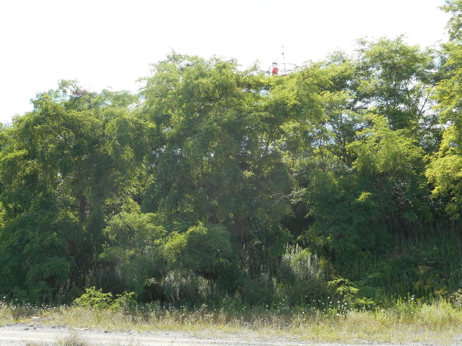
Getting closer to the end of the spit, you can see the path rise, into the Toplands, where the lighthouse is located.
From here, the path becomes pedestrian-only, and leads to the highest point in the park.
You can see the lighthouse in the distance.
Here are two views of the lighthouse, complete with antennae, foghorn, satellite dish and solar panels.
Looking down from the lighthouse, you see this path that leads to the shore, and Lighthouse Point. It's also referred to as Vicki Keith Point, after the Lake Ontario swimmer. Don't know which name is used more, though.
On the way back down the hill, and looking northeast and out to Lake Ontario, there is this large cove. The area in the distance is called The Flats.
And, in the opposite direction, another great view of the skyline. This was taken with the camera's zoom, to get the view I wanted. As you can see, it was a great day for sailing!
And, at "ground level," something I hadn't seen in a long time - snapdragons!
As a kid growing up in a small town, and on farms, I used to enjoy pinching the "jaws " of these flowers, giving the effect that they were opening and closing- hence the whimsical name.
Looking up from this level, you can see the very top of the lighthouse, just above the trees.
Moving down to the shoreline, I came across this collection, made by some anonymous person, of broken ceramic tiles, and some whimsical poems written in honour of them, and of this area of the park:
Looking northeast again, you can see that this entire shoreline consists of construction/demolition rubble of various types.
And, looking east out over the lake, more evidence of what a perfect day it was for sailing and boating...
These north and south views show that there is actually a rather precipitous drop of three to four feet down to the shoreline in this area - not to mention some pretty nasty bits of rubble at the bottom!
I considered jumping down to explore the shoreline more closely, but couldn't see a way to get back up, at least not without having to take a long detour.
I kind of had to take a pic of this rather lonely-looking bit of concrete stairs lying in the tide.
I had some slightly melancholy thoughts about where it came from - an apartment building? office building? Had children run up and down it in play? Office drones trod there in the course of business or perhaps a fire drill? Anyway, there it was, being slowly reclaimed by nature. (Sheesh - who's the poet now?)
Turning around from this area, the only view of the city skyline you get is the CN Tower - the pic again taken with the camera's zoom.
I continued northeast along the shore now, towards The Flats, and the entrance to the East Cove, which you can just make out in the distance, about the middle of the pic.
And, here is the East Cove, where several pleasure/sailboats had anchored on this glorious day. There was music playing, and some of the folks were diving off the boats for a swim.
(Walking the the trail past the East Cove, I saw a small, furry animal come out of the long grass, and speed across the trail to the brush on the other side. I thought it was an otter, but the guide back at the staff booth told me that there are wild mink in the park!)
I then got onto the endikement on the east side of the spit, and went back north, passing Cell Three again, this time with the city skyline in the background, and ducks and geese on the water.
The pic is taken with zoom to get a better look at the birds.
Continuing along Cell Three, you begin to get full views of the skyline again:
Regular camera view for this one.
Then, you approach Cell One, the wetland.
First pic taken from south of it, second from beside it.
And, a more southerly view of the wetland. I sat down on a log here for my first break of the afternoon.
It was pretty interesting to stop here, because the area looks quite bleak, but in the whole afternoon, I never saw as many birds and critters in one area as I did here. It must be the most "natural"-seeming area of the whole park!
Slightly north of this area, and on the lake side, is this large mound. Judging by the smooth slope you can see in the second picture, I'd guess it's still being used for dumping brick, concrete and tile rubble
I got a closer view of some of the tile on this mound. Just to right of centre, there appears to be a pice of marble, and to its right, a piece with a polished surface.
Here are three views from the top of this mound:
The first is looking southwest, and the swampy-looking area of Cell One:
Next, looking southeast, and the shore of Lake Ontario:
Finally, north, along the neck, and the lake shore:
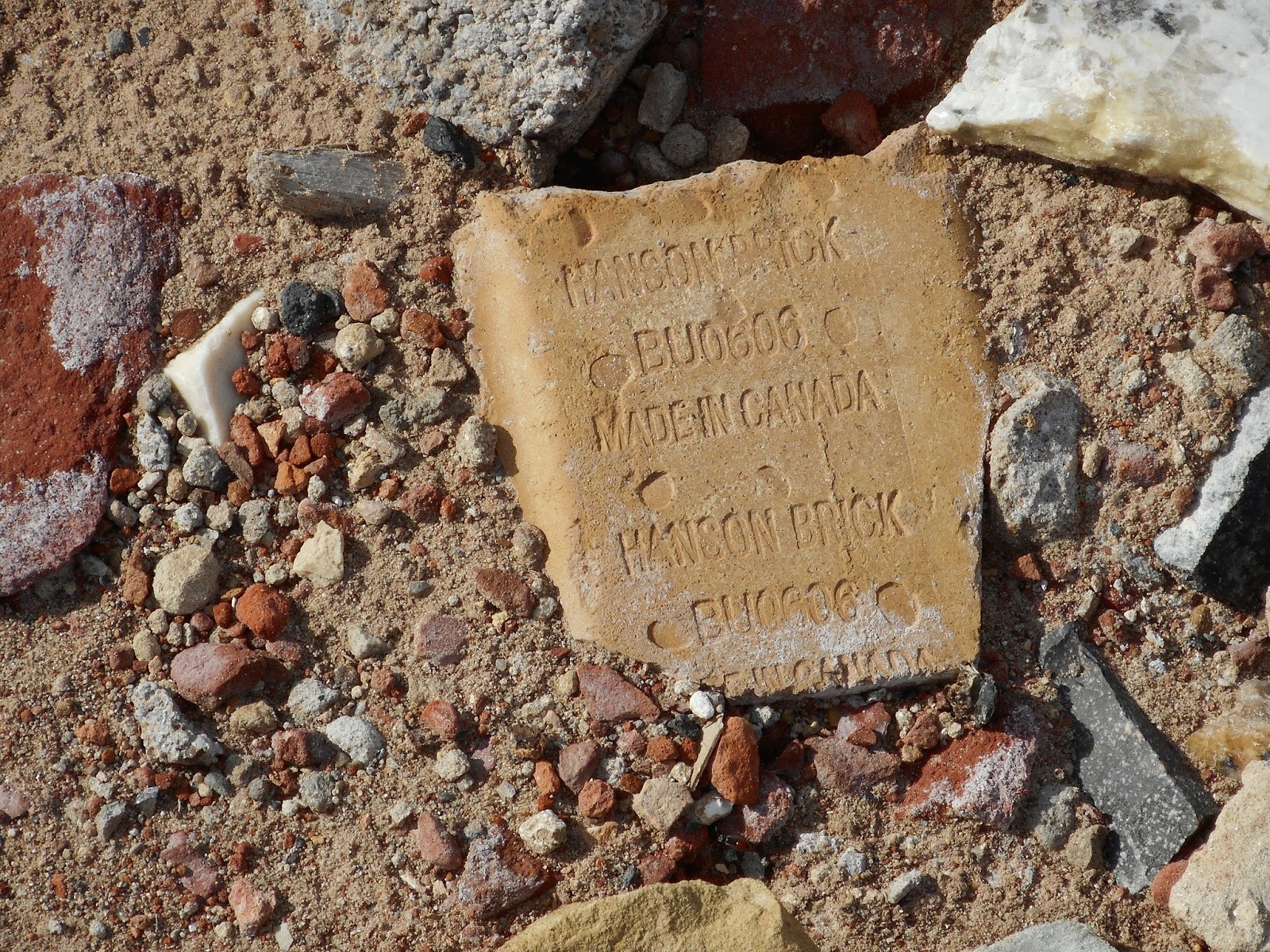
Finally, I thought I'd get a shot of this piece of brick, made by the Hanson company, which is headquartered in Burlington:
Continuing north along the neck, we're back to the wetlands area of Cell One.
I stepped off the main path, and was going along a small trail nearer the water to get a better pic of the marsh here.
Well, what to my wondering eyes should appear, but this beautiful brown rabbit!
I was about ten feet away so as not to disturb it, and used the zoom to get these pics.
I'll just let you enjoy these on their own...
Then, I had a brainstorm. Why not take a short video of this amazing creature?
Here it is - now, bear in mind, I was using the zoom, so it's a little jumpy in parts. But it was a real thrill!
And, farther along the trail, darned if another little critter didn't come out of the grass:
And, yet another one!
This one was hungry!
Still shaking my head, I continued north, to the top end of this marshy area, and got a couple of pics of the whole pond from a point looking south.
As I mentioned earlier, there was an unpaved pedestrian-only path along the neck, and this is what I followed north for the rest of my walk.
That's my shadow in the bottom right there. As you may guess by the shadows, the afternoon was getting on.
From there, the skyline comes into view again, and I got this pic with the camera's zoom:
You're very close to the lake shore on this path, and there were lots of geese and ducks enjoying the water.
And, in the last view looking north, you can see how the shore consists of these rounded rocks, as well as bits of concrete and rebar.
I stepped onto these rocks to get this pic, and stumbled a bit - they are wobbly, and can be treacherous!
And, finally, a last view of the marina, and the skyline in the background (also taken with zoom):
This was an awesome walk, and the perfect day for it.
More long, hot summers are coming, and though I'm no fan of really hot weather (especially coupled with humidity), I hope to find more days like this in the future to explore this amazing wildlife area, only a short distance from where I live, and pretty convenient to downtown, too.
There are certainly areas I didn't explore, wanting to take the whole thing in this time around, so I'll come back here again to see how this area is changing and growing.
Till then...